Evolución geomorfológica de Punta Rasa, Pcia. de Buenos Aires, Argentina
Palabras clave:
geomofología, erosión, costas,Resumen
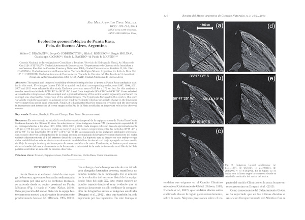
The spatial and temporal variability observed during the last 25 years at Punta Rasa sandspit is studied in this work. Five images Lansat TM (30 m spatial resolution) corresponding to the years 1987, 1994, 2001, 2007 and 2011 were selected in this study. Each one covers an area of 185 km x 172 km but, for this analysis, a smaller area from latitude 36°19´40” to 36°17´08” S and from longitude 56°44´10” to 56°47´25” S was selected. A remarkable retrogression of the sandspit and a gradual widening of the sector located adjacently southward the sandspit was observed by comparison of the selected images. The hypothesis discussed in this work is that such variability would be associated to a change in the wind wave climate which arose a slight change in the long shore wave energy flux and in sand transport. Finally, it is highlighted that the mean sea level rise and the increasing in frequencies and intensities of storm surges in the Río de la Plata could play an important role in the observed erosion.
Descargas
Descargas
Publicado
Número
Sección
Licencia
Los autores/as que publiquen en esta revista aceptan las siguientes condiciones:- Los autores/as conservan los derechos de autor y ceden a la revista el derecho de la primera publicación, con el trabajo registrado con la licencia de atribución de Creative Commons, que permite a terceros utilizar lo publicado siempre que mencionen la autoría del trabajo y a la primera publicación en esta revista.
- Se permite y recomienda a los autores/as a publicar su trabajo en Internet (por ejemplo en páginas institucionales o personales), ya que puede conducir a a una mayor y más rápida difusión del trabajo publicado.
